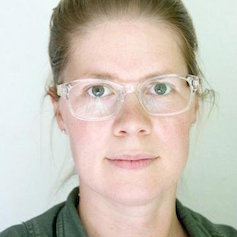
Susanna Werth
Research Professor at the School of Geographical Sciences & Urban Planning and the School of Earth and Space Exploration
Susanna Werth is a Geodesist/Engineer specialized in satellite gravimetry, large-scale hydrology and water resource management. Her research interests are the time-dependent Earth and planetary gravity field, hydrology, terrestrial water cycle and resources management, interaction of the water, climate, environmental and human societies as well as signal processing. A main focus of her research is on monitoring, modeling and forecasting the Earth’s water mass budget variations using remote sensing data. This multifaceted research effort includes: Enhancing techniques for monitoring water mass budget variations with a focus on gravity and deformation data; Obtaining and analyzing large-scale estimates of temporal changes in continental water mass budget; And investigating impact of changes in water availability on environment, human societies as well as crisis management.
lab friends

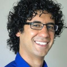
Manoochehr Shirzaei
Assistant Professor at the School of Earth and Space Exploration
With his research team, Manoochehr conducts interdisciplinary research covering wide spectrum of geophysical and industrial processes, such as seismic and aseismic faulting, volcanism, landslide, land subsidence, induced seismicity, coastal erosion, hydrocarbon reservoir, pipe lines and geothermal, hydrothermal and nuclear power plants. We are not restricted to the Earth and try to expand our research to entire solar system.
researchers

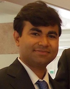
Chandrakant Ojha
Postdoctoral Researcher at the School of Earth and Space Exploration
Remote sensing of large scale crustal deformation in California due to depletion in water resources
States across southwest USA, in particular California, are currently undergoing a severe drought on
large spatial extents, which causes shrinkage of the surface and groundwater resources and severe subsidence on the surface. A
comprehensive monitoring schemes to enhance drought management and mitigating the negative
impacts at various spatial and temporal scales is an essential. The research effort will focus on acquisition of
a high resolution 3D deformation map obtained through InSAR processing of SAR images acquired by
various satellites (2003-present) and GPS measurements over the state of California.
Results from this project will assess the capabilities of InSAR to monitor aquifer systems and of a
combination with GRACE gravity data to acquire high resolution spatiotemporal
observations of TWS variations.
graduate students

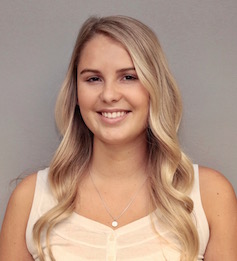
Grace Carlson
School of Earth and Space Exploration
Remote sensing and modeling of total water storage variations in California
States across southwest USA, in particular California, are currently undergoing a severe drought on
large spatial extents, which causes shrinkage of the surface and groundwater resources. Thus, a
comprehensive monitoring and modeling schemes to enhance drought management and mitigating the negative
impacts at various spatial and temporal scales is an essential. The proposed research effort will perform
a joint analysis of the deformation and gravity data to obtain maps of TWS variations, on various scales
ranging from 100s of m to 1000s of km. We will combine the archive of gravity data obtained by
GRACE satellites (2002-present) with high resolution 3D deformation data based on InSAR and GPS measurements over
the state of California. A combination through a Bayesian inverse modeling scheme will provide multiscale estimates of water storages
variations and its uncertainty. Thus it delivers unique constraints on the timing and extent of hydrological
mass fluxes, useful for probabilistic drought forecast and management. Results from this project will assess
the capabilities of InSAR in combination with GRACE and GPS data to provide high resolution spatiotemporal
observations of TWS variations.
